Traversing the Crown Range & Southern Alps
Published by MoanaTrails Editorial Team • 8 min read • Verified Route Data
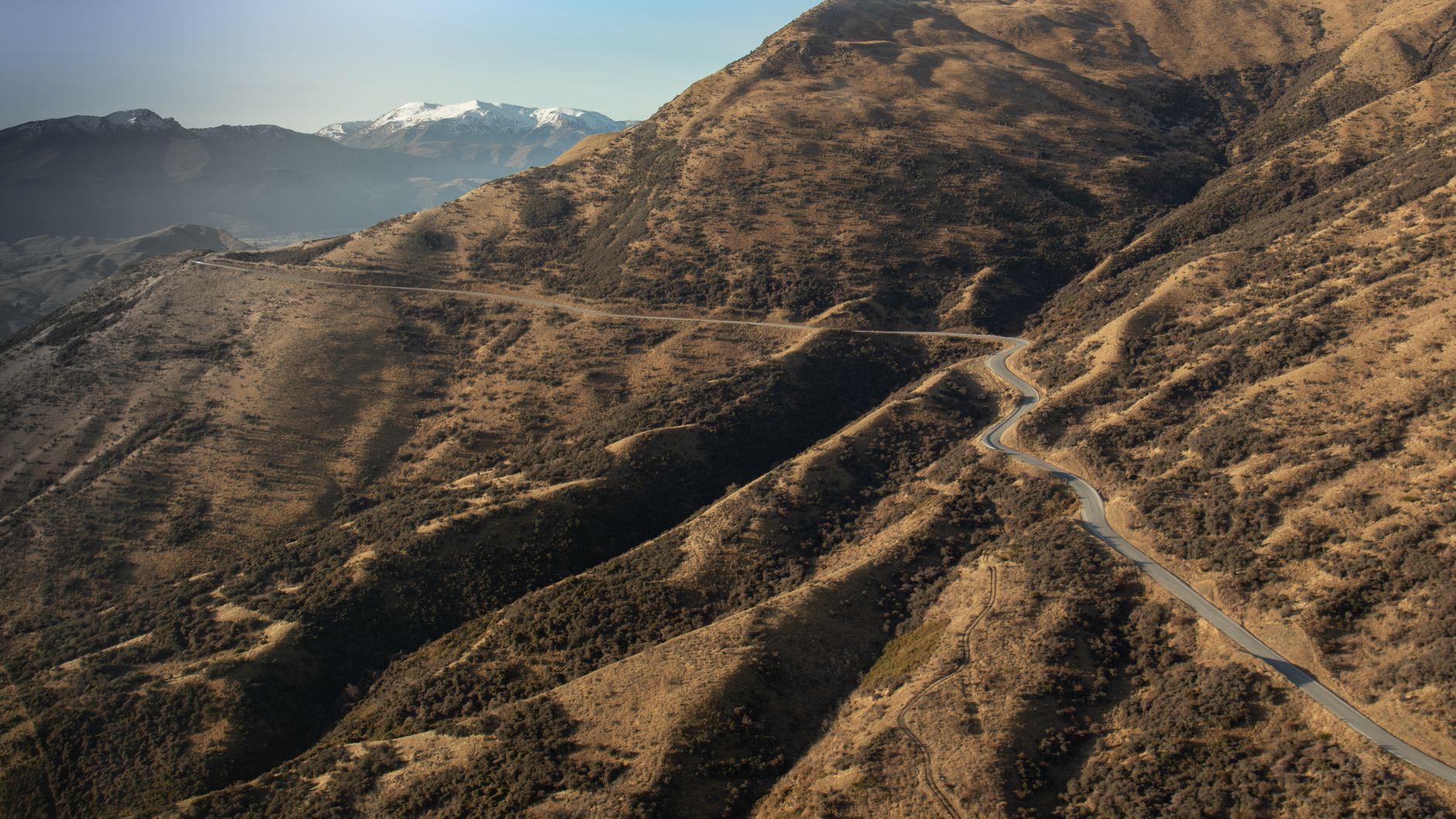
Connecting Queenstown to the alpine town of Wanaka, the Crown Range Road peaks at 1,076 meters above sea level, earning its title as New Zealand’s highest paved public thoroughfare. While modern sealed tarmac has replaced the grueling gravel of decades past, traversing this alpine ridge remains an invigorating, technical drive requiring acute seasonal awareness.
Navigating the Zigzag Switchbacks
Departing the Wakatipu Basin, the road initiates its steep ascent through a cluster of dramatic hairpin switchbacks known affectionately as the 'Crown Range Zigzag'. Drivers of large campervans or motorhomes should maintain second gear on the ascent to avoid overheating transmissions, while respecting the designated slow-vehicle pull-outs for passing traffic.
“The lookout summit reveals the entire expanse of Lake Wakatipu nestled against the Remarkables Range. On clear winter mornings, the valley remains trapped under an unbroken inversion sea of fog.”
Crucial Winter & Shoulder Season Precautions
Between May and October, this road transforms dramatically. Black ice is common along shadowed corners and high winds frequently sweep the plateau. Drivers in New Zealand are legally required to carry fitted snow chains during extreme alpine weather advisories. If conditions turn severe, the alternative route via the Kawarau Gorge and Cromwell—while 25 minutes longer—offers a substantially flatter and safer passage.
- Check the NZTA Traffic Portal: Always verify highway status through Waka Kotahi before departure.
- Braking Technique: Shift down to engine brake when descending into the Cardrona Valley to prevent brake pad overheating.
- Stop at the Historic Cardrona Hotel: Founded in 1863 during the gold rush era, this heritage watering hole serves excellent warm fare beside an open stone fireplace.
Continuing North to Wanaka
Once you descend into the peaceful Cardrona river valley, the driving becomes tranquil. Rolling tussock terrain gradually transitions into lush farmland as Lake Wanaka approaches. Allocate at least two full hours for this 70-kilometer route to accommodate photography stops, coffee breaks, and careful driving.
Need a Custom South Island Road Map?
Our editors craft tailored, sensible driving schedules that eliminate stress and avoid hazardous night drives.
Book Itinerary Consultation